
Pagasa spots LPA off Surigao
A low-pressure area that developed off Mindanao yesterday is likely to trigger the rainy season next week, state weather forecasters said.
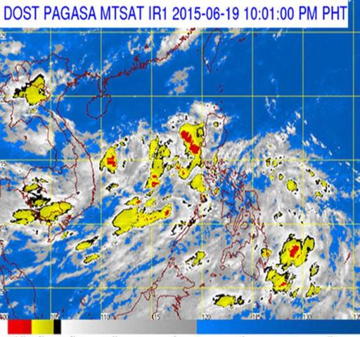
According to the Philippine Atmospheric, Geophysical and Astronomical Services Administration (PAGASA), the low-pressure area was spotted at 220 kilometers east of Surigao City as of 10 a.m. yesterday.
PAGASA weather forecaster Chris Perez said the low-pressure area has a slim chance of intensifying into a tropical depression, but it is forecast to dump rains over eastern and central Visayas, Caraga and northern Mindanao this weekend.
The low-pressure area is expected to move up to Luzon on Sunday, bringing light to moderate rains in many areas, including Metro Manila.
Perez also said the low-pressure area is likely to enhance the southwest monsoon. The prevalence of the southwest monsoon is one of the criteria in declaring the onset of the rainy season in the western section of the Philippines with a Type 1 climate.
Areas under Type 1 climate include Metro Manila, Palawan, Mindoro, Cavite, Batangas, Bataan and Zambales. Type 1 climate has two pronounced seasons – dry and wet. The dry season is from November to April and the rest of the year is the wet season.
“We might declare the rainy season by middle of next week,” Perez said.
Weathermen blamed the prevailing El Niño phenomenon for the delay in the onset of the rainy season in the country.
Last year, the weather bureau announced the start of the rainy season on June 10.
-------------------------------------
-------------------------------------

Post a Comment